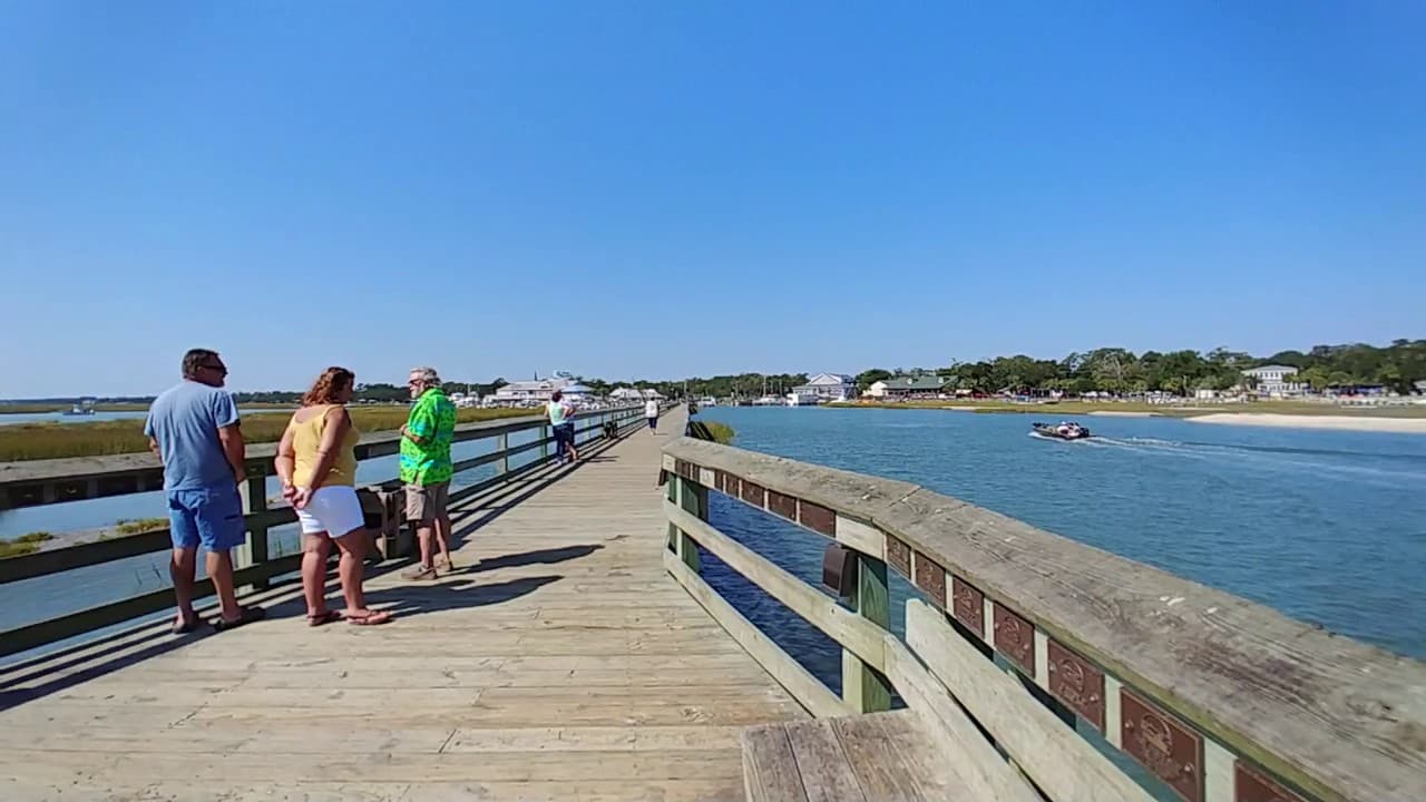
Murrells Inlet MarshWalk
OpenMurrells Inlet300 ftFree (public access)Official site
Marsh/inlet fishing, not a traditional ocean pier
4012 US-17 BUS, Murrells Inlet, SC 29576300 ftFree (public access)
Observed 32 min ago
Conditions at Murrells Inlet MarshWalk
Everything the sensors and the forecast office report for this pier right now, plus the tide schedule for the next two days.
Water temp
83.9°F
Buoy: Springmaid Pier
Air temp
85°F
78% humidity
Wind
6 kn S
Gusts to 7 kn
Sky
Chance Showers And Thunderstorms
NWS forecast office
Visibility
—
Surf
1.9 ft
Tide
Rising
Rising tide · next turn in 68 min
Water and air
- Water temperature
- 83.9°F
- Air temperature
- 85°F
- Humidity
- 78%
- Wave height
- 1.9 ft
Wind and sky
- Sustained
- 6 kn
- Direction
- S
- Gusts
- 7 kn
- Sky
- Chance Showers And Thunderstorms
Pressure and light
- Barometric pressure
- 1015.5 mb
- Visibility
- —
- UV index
- —
- Tide state
- Rising
Beach flag
Flown by the lifeguards for the surf beside the pier. It describes swimming, not fishing — but a double-red day usually means a rough, stirred-up bite too.
Low Hazard
Calm conditions. Exercise normal caution.
Updated 8 days ago
4 high · 4 low over the next 48 hours
Upcoming highs and lows
Next up: high tide at 4:16 PM, 4.9 ft.
Aug 22, 2026
| Tide | Time | Height |
|---|---|---|
| High | 4:16 PM | 4.9 ft |
| Low | 10:53 PM | 1.5 ft |
Aug 23, 2026
| Tide | Time | Height |
|---|---|---|
| High | 4:30 AM | 4.0 ft |
| Low | 10:43 AM | 1.1 ft |
| High | 5:09 PM | 5.1 ft |
| Low | 11:39 PM | 1.3 ft |
Aug 24, 2026
| Tide | Time | Height |
|---|---|---|
| High | 5:24 AM | 4.2 ft |
| Low | 11:30 AM | 0.9 ft |
Where these numbers come from
Tides come from NOAA CO-OPS. Air temperature, wind, pressure, humidity and sky come from the National Weather Service gridded forecast, with the Open-Meteo model as a fallback. Sea state comes from the Open-Meteo marine model. Nothing on this page is measured on the pier deck itself — the nearest station can read a degree or two off what you feel.
- NOAA tide station
- Garden City Pier (ocean)#8661437
- NOAA water station
- Springmaid Pier#8661070
- NWS forecast grid
- ILM 53,40
- Last observation
- 32 min ago (3:07 PM)
Source for each reading
- Tide
- NOAA CO-OPS station 8661437
- Water temperature
- NOAA CO-OPS station 8661070 anchored, Open-Meteo gradient (+0.2°F)
- Weather and wind
- National Weather Service grid ILM 53,40
- Barometric pressure
- NOAA CO-OPS station 8661070
- Sea state
- Open-Meteo marine model
- Sun and moon
- computed locally (suncalc)
Springmaid Pier holds the only water-temperature gauge on the Grand Strand. Other piers show that reading adjusted by the along-shore difference the marine model reports, so the number is anchored to a real instrument rather than guessed — but it is not a thermometer at that pier. Tide predictions are astronomical: wind and pressure can push the real water level either side of them.
Data from NOAA CO-OPS, the National Weather Service, and Open-Meteo (CC BY 4.0).
Times are Eastern.